Cranberry Peatlands Interpretive Area

Cranberry Peatlands

Wetland Classification

The Cranberry Peatlands Interpretive Area is a complex of wetland types.  Close to the road and on the south side it’s a treed to semi-treed bog with tamarack and black spruce, labrador tea and leatherleaf.On the north side where it was mined in the 1950’s and has recently experienced higher water levels it is most like a marsh.  About 250m down the trail the semi-treed bog grades into a poor fen where it borders on the forest edge.  Here the trees are scattered and stunted and sphagnum moss hummocks are pretty little micro-communities of bog rosemary, cranberry and leatherleaf.  Continuing along the trail the wetland simplifies into an open bog.  The trees thin out, except along remnants of the old road whee the ground is a little higher, and in the last two high water summers every footstep is accompanied with a musical burble and a sinking feeling.

Bog Ecology

One characteristic that makes a bog a bog is its position above mineral rich ground water.  Over time, the nutrient poor environment and increasing acidity exclude the plants which require the richer environment of a fen.  If you consider diversity at the species level, bogs don’t seem like very happening places because they’re species poor.  But they’re a unique community type and a quiet testament to the saying “nature abhors a void”.  Once the moss mat builds above water level, minerals no longer come to the bog environment from ground water but come from rainfall.  Sphagnum mosses make conditions more extreme, actively acidifying their environment by taking up calcium and magnesium ions and releasing hydrogen ions.  This enables them to survive even near the basic waters common in Alberton.  Many plants cannot tolerate bog conditions but bogs on the whole contribute to biodiversity by serving as refuges for highly specialized plants like the Pitcher Plant, by controlling drainage and storing water and by providing a greater range of water chemistry and physical habitats than would exist without them.

History of the Cranberry Peatlands

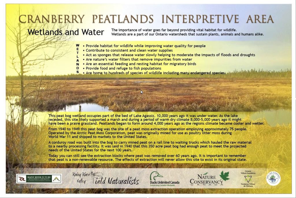
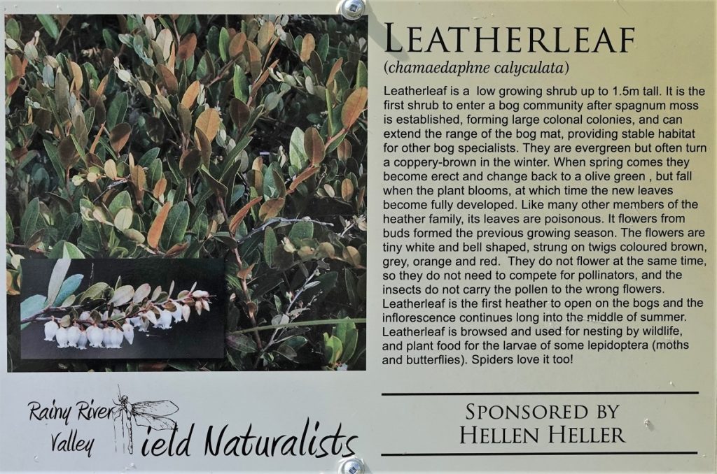
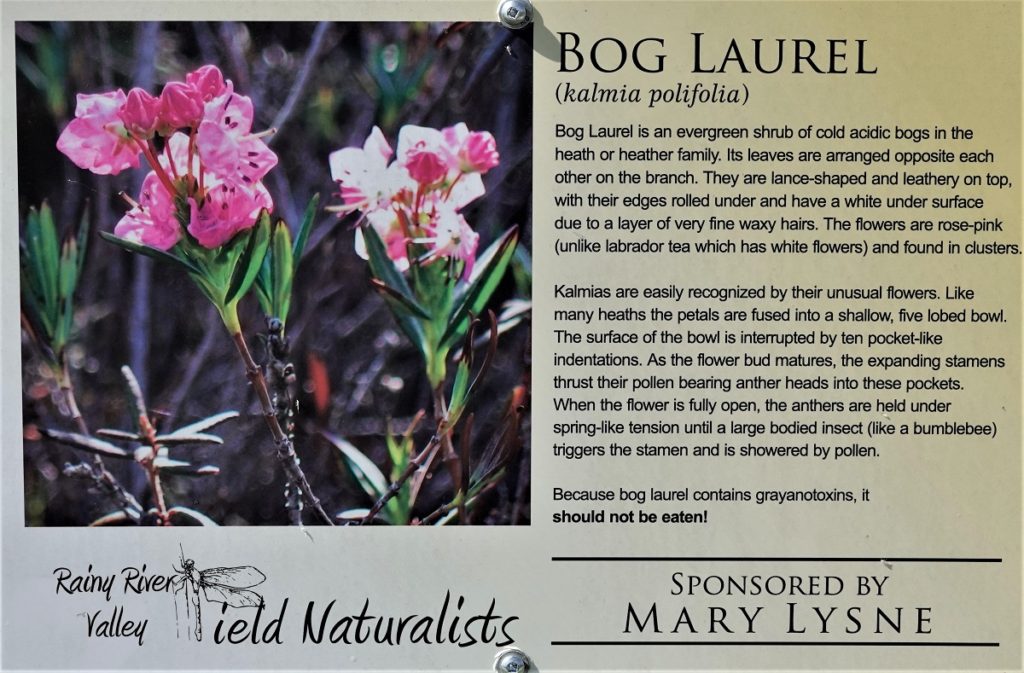
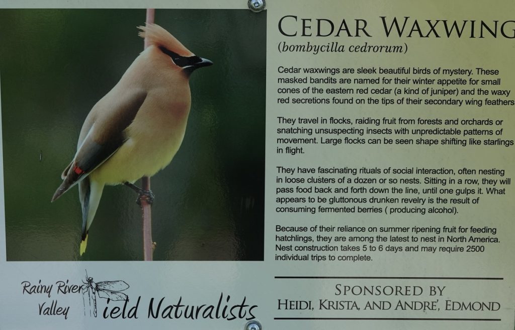
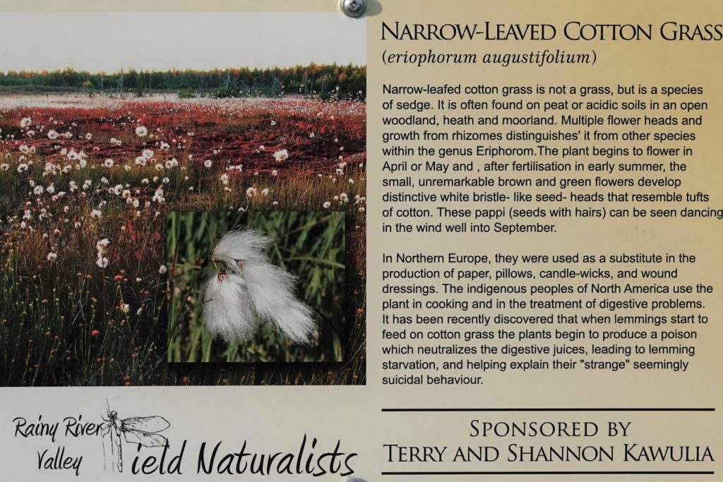
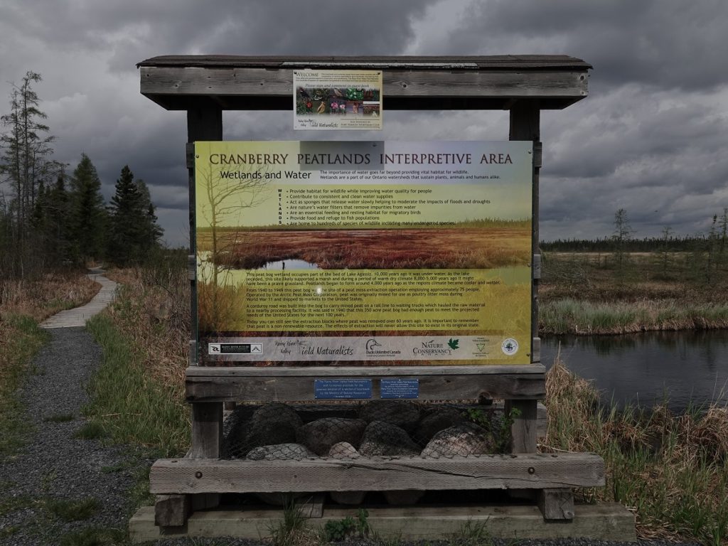
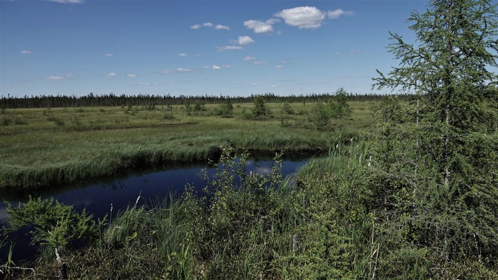
Arctic Peat Moss Corporation ran a peat mining operation at the west end of Whitmore Road in the 1940’s. The moss was dug out from trenches and piled alongside it to drain the water.  It was re-stacked or placed on wooden racks to dry, then taken to ashed for milling, grading and packing.  The business employed up to 90 people in the summer and around 20 people year round, processing moss for export to the U.S. for flooring for poultry flocks.

Gilbert Gillies worked as the mill foreman there from 1942-45.  In an article about the site in the Fort Frances Times (April 12, 1989) he ad his wife Ruby reminisced about their house, the bog being 12 feet deep, getting equipment stuck in the bog, and a fire in Januaru 1944 which broke out and burned a week’s worth of peat in one of the sheds.

The article ended on this quote from Gilber, “Anyone who drives down there would never imagine that al this was once a real hub of activity.”

Cranberry Peatlands Interpretive Boardwalk

For several years members of the RRVFN had been observing the area, noting its significance for protection.  In April 2002 the club presented the Alberton Council with plans for an interpretive boardwalk and viewing platform.  The Council agreed to support the proposal, and work on the boardwalk was finally begun in 2005 after a three year hiatus during which time several planning obstacle had to be overcome.  Although the boardwalk was officially opened in 2006, work  continued  over the years, extending the boardwalk.  In 2010 an observation platform was built, and in 2018 members of the club secured additional funding and were able to extend the boardwalk a further 100m.  You can follow the development of the boardwalk from the initial proposal acceptance by the Alberton Council to the latest work on the boardwalk here in articles from the Fort Frances Times.

Funding

Over the years many people and organizations have contributed in monies and sweat equity to bring the project to its realization. A heartfelt thank you is extended to all (and we apologize in advance to anyone or organization that has been accidentally overlooked).

Location

The Cranberry Peatlands Interpretive Area is approximately 12 km west of Fort Frances.  From Fort Frances it can be reached either from Hwy 11/71, turning left onto Hwy 601, and right onto Whitmore Road.  Follow Whitmore 2 km to its end.  There is a small parking area just before reaching the boardwalk. Or from Hwy 602, right onto Stewart Road and continuing straight onto Whitmore Road.

Close Menu